About the Safety Review
The Nottawasaga Valley Conservation Authority (NVCA) will be conducting a safety review of the Pretty River Dike to assess its structural stability.
The safety review will involve two weeks of borehole drilling to confirm the structural integrity of the dike. Equipment will also be installed to monitor internal pressure within the dike structure. A drill rig will be traversing River Trail and may impact residents’ access to limited portions of the trail.
When using the trail system along the Pretty River Dike, residents are reminded to be vigilant around the drill rig, as it can pose a hazard to unauthorized individuals. Signage and safety measures will be in place to direct trail users to avoid the impacted area.
The Pretty River Dike safety review will help NVCA identify required rehabilitation and maintenance needs, which will then be addressed by NVCA in the coming years.
History of Flooding in Collingwood
The Town of Collingwood was built on a shallow floodplain, making it prone to floods. Some of the most notable floods are the 1912 Victoria Day Flood and the 1942 St. Patrick’s Day Flood.
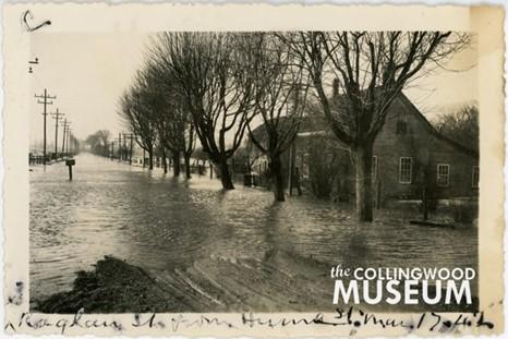
This is a view of Hume Street during the 1942 St. Patrick's Day flood. Photo contributed by the Collingwood Museum Huron Institute 2789; Collingwood Museum Collection X973.523.1, X973.524.1, X973.525.1
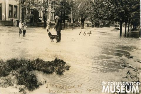
This photo was taken near the intersection of Third and Birch streets during the 1912 Victoria Day flood. Photo contributed by Collingwood Museum Huron Institute 148, 150, 164, 165; Collingwood Museum Collection X970.794.1, X969.594.1, X970.783.1, X970.789.1
The Pretty River
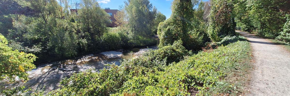
The Pretty River is one of four rivers that flow through the Town of Collingwood. It starts on the Niagara Escarpment, and flows through the Pretty River Valley. As it enters the town, it is contained by the Pretty River Dike as it flows to the Nottawasaga Bay
The Pretty River Dike
In the 1970s, the Pretty River Dike was built to reduce the risk of flooding in the urban areas of Collingwood.
It is designed to contain the floodwaters from the Provincial Regulatory Storm Event — a storm so extreme that the likelihood of it happening is less than 1% chance in any given year. Although these events are rare, the risk to property damage and possible loss of life is high which is why the dike must be maintained.
This 2 km flood control structure starts at the southwest intersection of Peel Street and Lynden Street, passing the old CN Rail bridge (now the Siding Trail), then Hume Street and the Pretty River Parkway before ending at Oliver Crescent near the shore of Nottawasaga Bay.
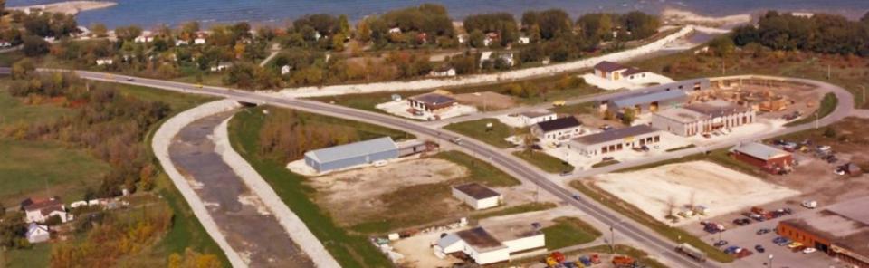
This is what the dike looked like in the 1970s right after it was built. As time went on, vegetation began to grow on the dike. Taking a closer look, the dike is covered in 12” to 18” stone which protects the banks from the erosive forces of flowing water.
The Pretty River Dike is divided into sections.
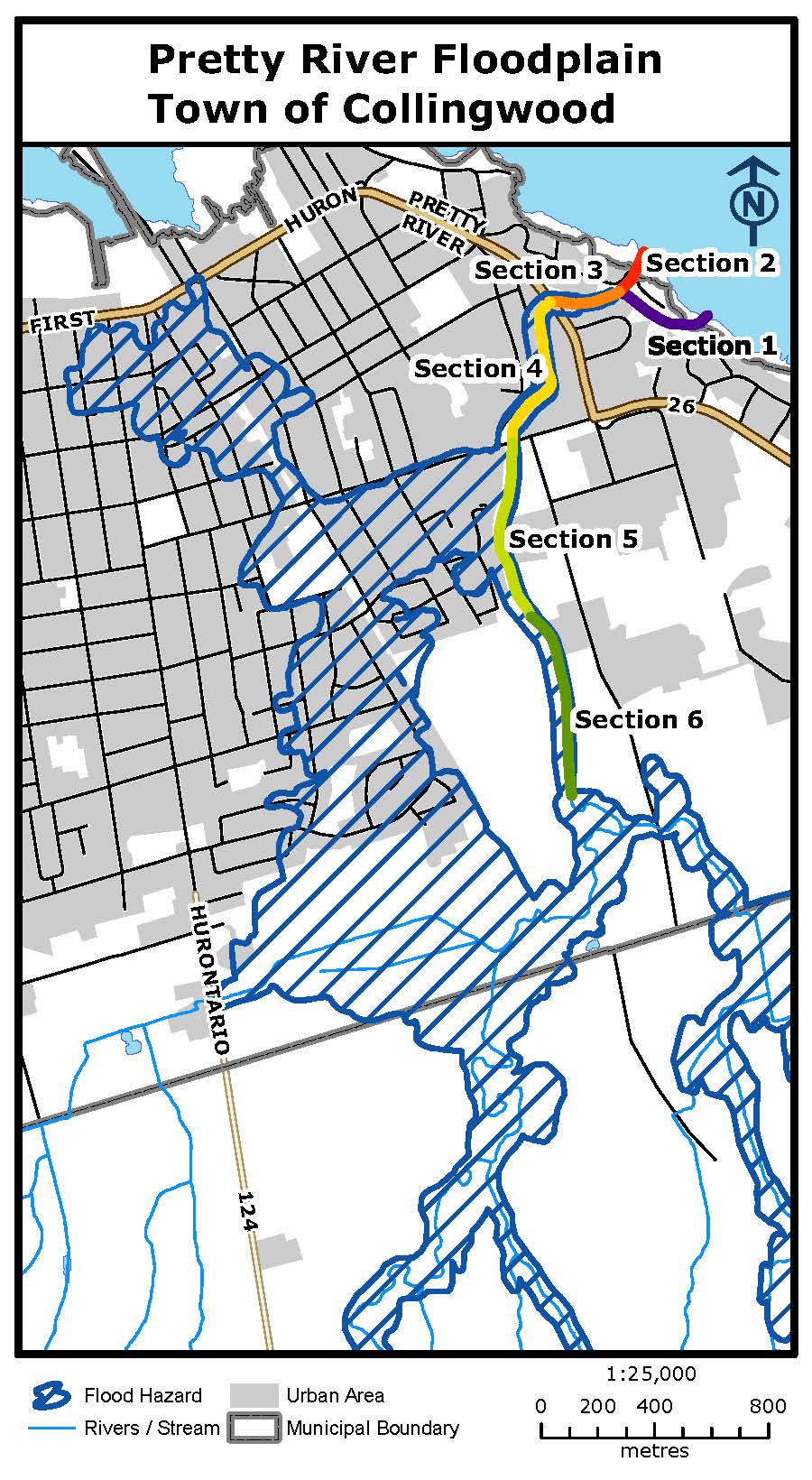
Section 1: Bypass Culverts to Nottawasaga Bay
Section 2: Bypass Weir to Nottawasaga Bay
Section 3: Pretty River Parkway to Bypass Weir/Culverts
Section 4: Hume Street to Pretty River Parkway
Section 5: Barrie Collingwood Railway (Siding Trail) to Hume Street
Section 6: Start of Pretty River Dike to Barrie Collingwood Railway (Siding Trail)